Topographic Surveys
![]()
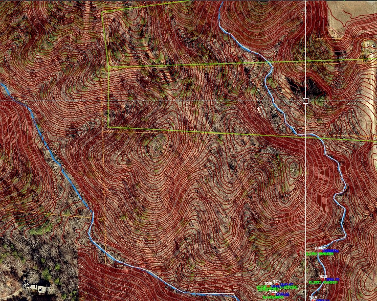 In many cases, commercial and residential property development requires a detailed survey of the existing physical features on property, both natural and man-made. LDP provides detailed, accurate commercial topographic surveys that not only meet the requirements of local zoning authorities, but also provide a clearer understanding of how the land should be developed. For a deeper understanding of the various physical features on your property, LDP can provide an accurate and detailed topographic survey of your land. Sometimes called a “contour” survey, this type of survey is used to determine the elevations throughout a piece of property—that is, taking into account not only the horizontal boundaries of your land, but also the vertical features, both natural and man-made (e.g., trees, hills, ravines, poles, walkways, streams, etc.). A topographic survey can serve a number of vital purposes, but especially if you are planning improvements on your land that could affect the landscape.
 When do You Need a Topographic Survey
A topographic survey is typically conducted for residential or commercial properties for any of the following reasons:
- To identify optimal sites for building on the land
- To identify water runoff patterns on the land and create drainage or grading solutions to divert drainage away from structures
- To resolve current standing water issues without creating new ones
- For optimal planning of additional infrastructure like roads, electrical and plumbing
- To evaluate possible effects of development on the landscape
- As a requirement for obtaining permits by local zoning authorities
What to Expect With a Topographic Survey
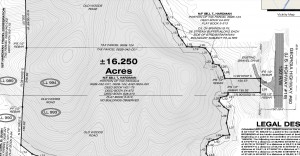
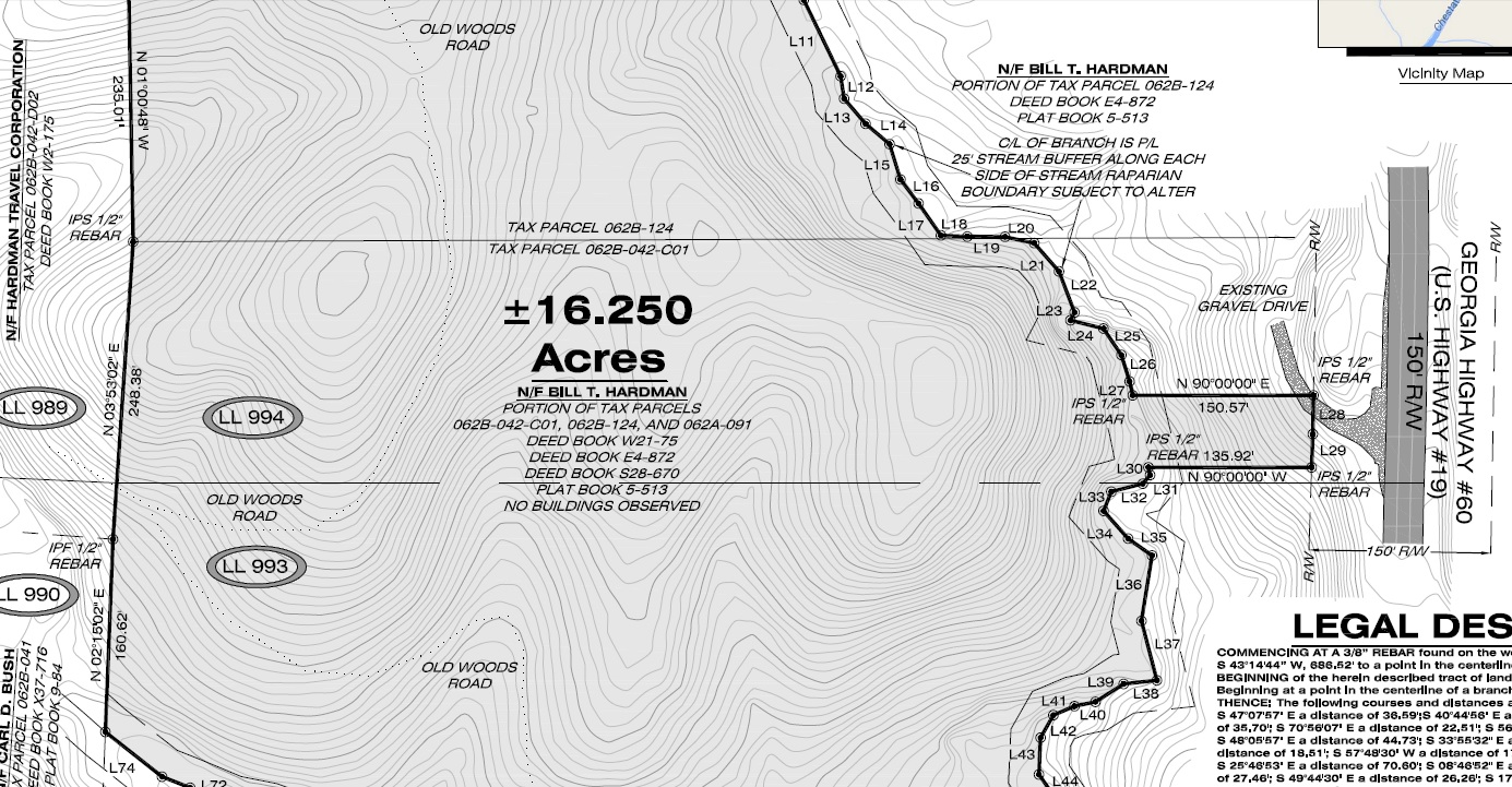
Unlike a boundary survey which marks corners and property lines, a topographic survey details the various elevations and physical features of the property. LDP will conduct a thorough on-site analysis of your land to identify and note these features. The resulting topographical map will identify elevations drawn as contour lines showing the relative heights of the ground throughout the property (for this reason, this is often referred to as a “contour survey”). Additionally, the map will mark all physical and man-made features on-property, including trees, hills, pathways, roads, streams, poles, manholes, and so on.
Whether or not your local jurisdiction requires it, a topographic survey provides data that is absolutely essential to planning smart improvements and developments of the land that won’t cause more problems later on. For more information, contact LDP today.

Homeadvisor